Yorkshire Archaeological Journal | Digital copy now free to download

YAJ volumes◊ Dear Microburins

The Yorkshire Archaeological & Historical Society has completed a major investment in digitizing their journal from volume 1 (1870) to volume 82 (2010). The journals are also searchable and can be downloaded in a range of formats. There are many important Mesolithic and prehistoric articles.

Volumes from 2011 until present are commercially published by Maney, followed by Taylor and Francis, and so digital and print copies are available for a charge to non-members.

View the journals online »
Read more about what is available and planned next »

Spence

Mesolithic Infamy? | Interview with These Bones of Mine

Guest Interview: Turbulence Ahead? Introducing Archaeologist and Agitator Spencer Carter

◊ Dear Microburins,

It’s been a huge pleasure to be interviewed by David Mennear – over the last few months due to some medical challenges we have both faced, and survived.

Read the interview »

Spence

BOOZE IN THE BARN | Digging up Time in the Dales

LOD16_Kids01DAY OF ARCHAEOLOGY 2016 | Hunters, Farmers, Cistercian Habits, Mullions, Methodists, Water and a Loo in the Woods

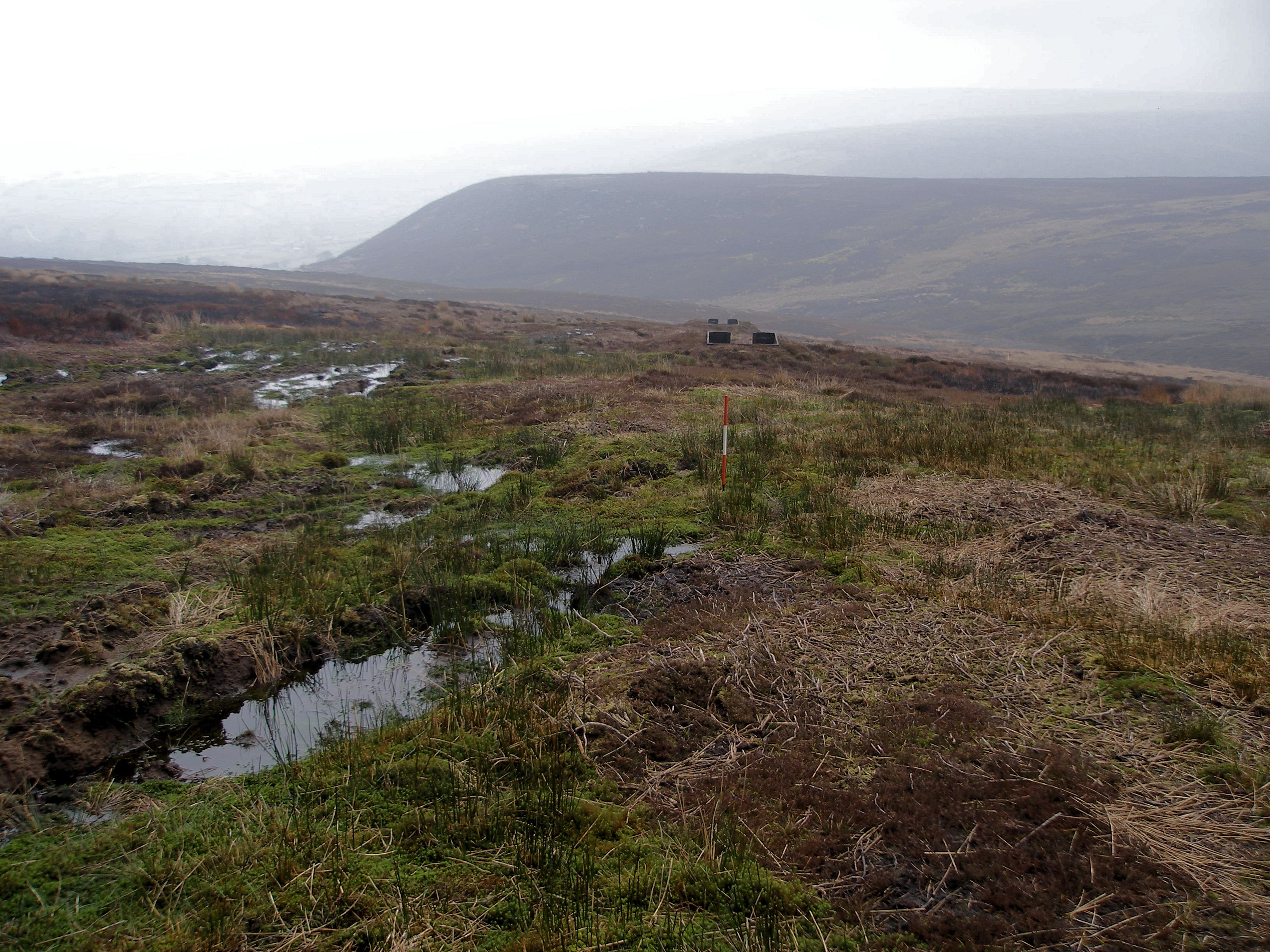
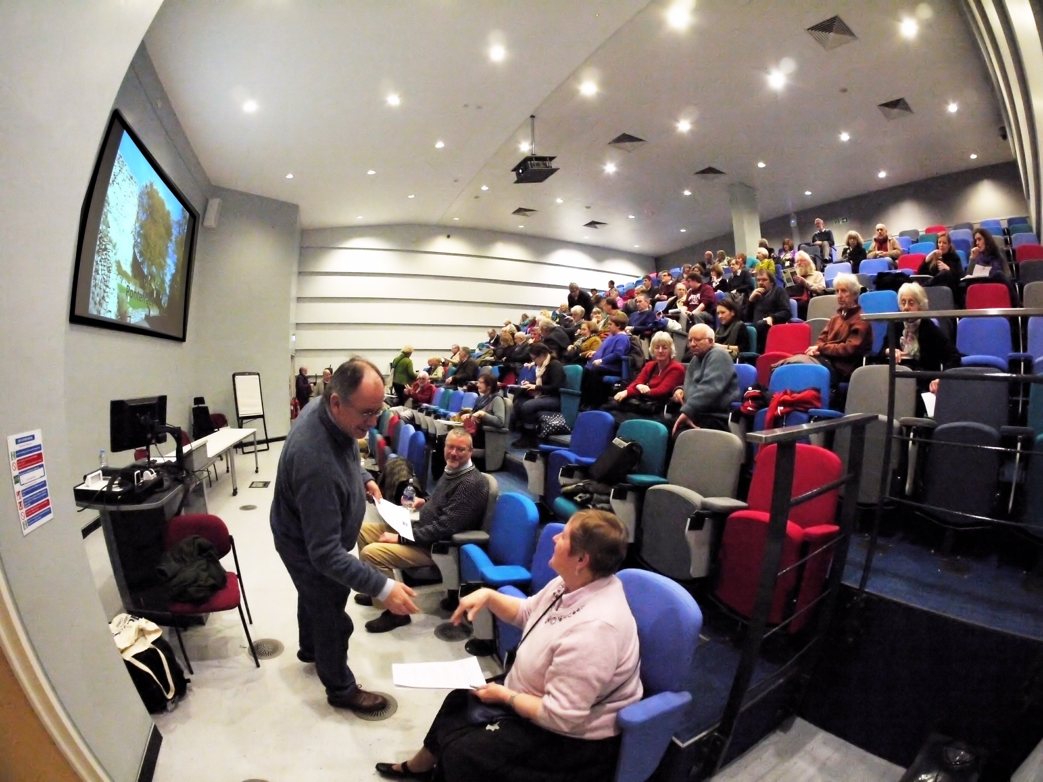
My DoA post this year is, perhaps, closer to the traditional perceptions of what archaeologists do, and comes the week after completing fieldwork in the beautiful Nidderdale in North Yorkshire, England — an Area of Outstanding Natural Beauty (AONB) and over 10,000 years of human presence. Our 2016 project is funded by the Heritage Lottery and seeks to understand the history (and prehistory) of The Lost Village of Lodge on the Scar House Reservoir which still, today, supplies drinking water to the city of Bradford — by gravitational pipe! To give a flavour of the varied activities over two weeks of digging, I hope readers will allow me to compress into a single ‘virtual’ day of archaeology.

Day of Archaeology 2016 »

How do you lose a village?

Lodge-May-2013-1040x300
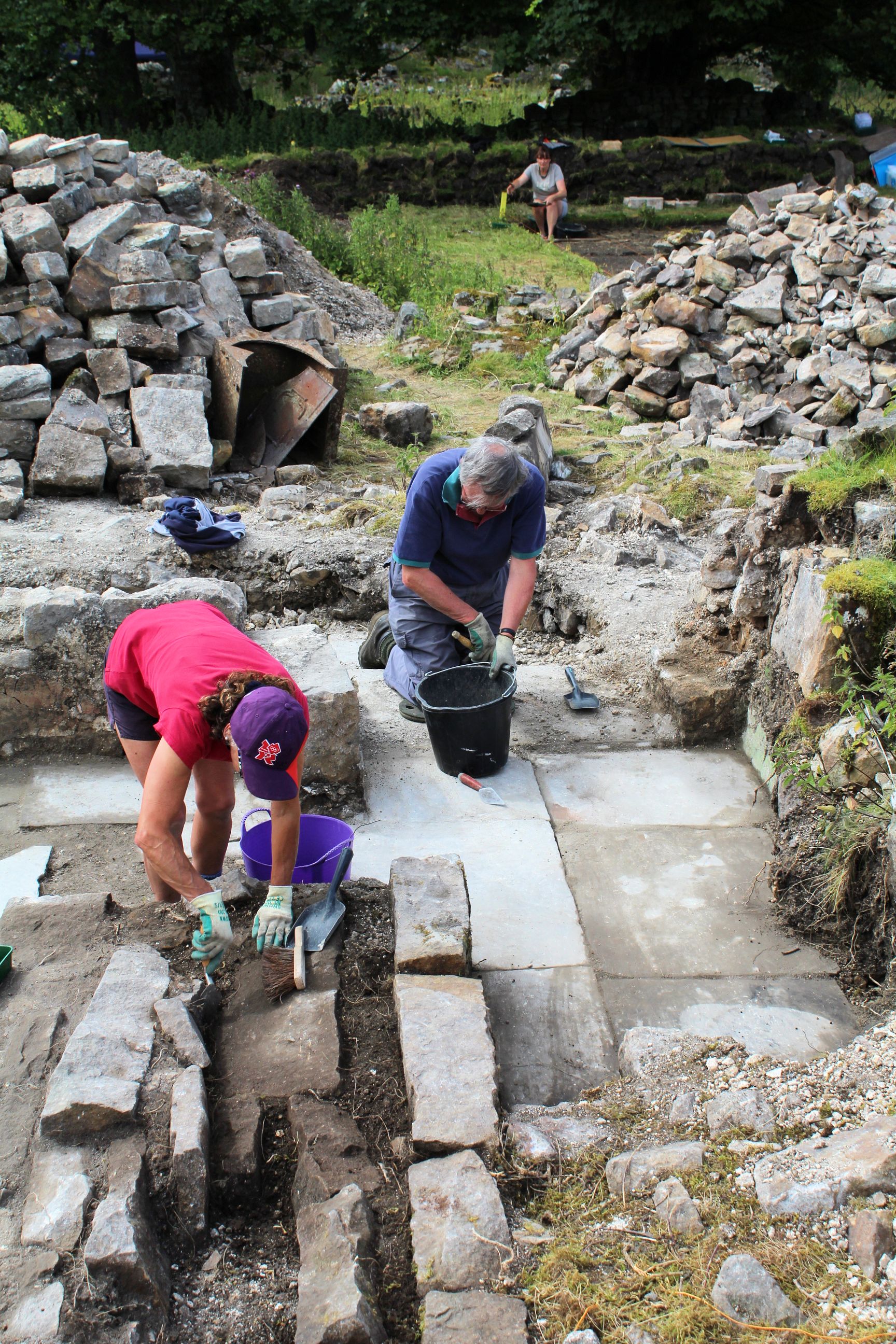
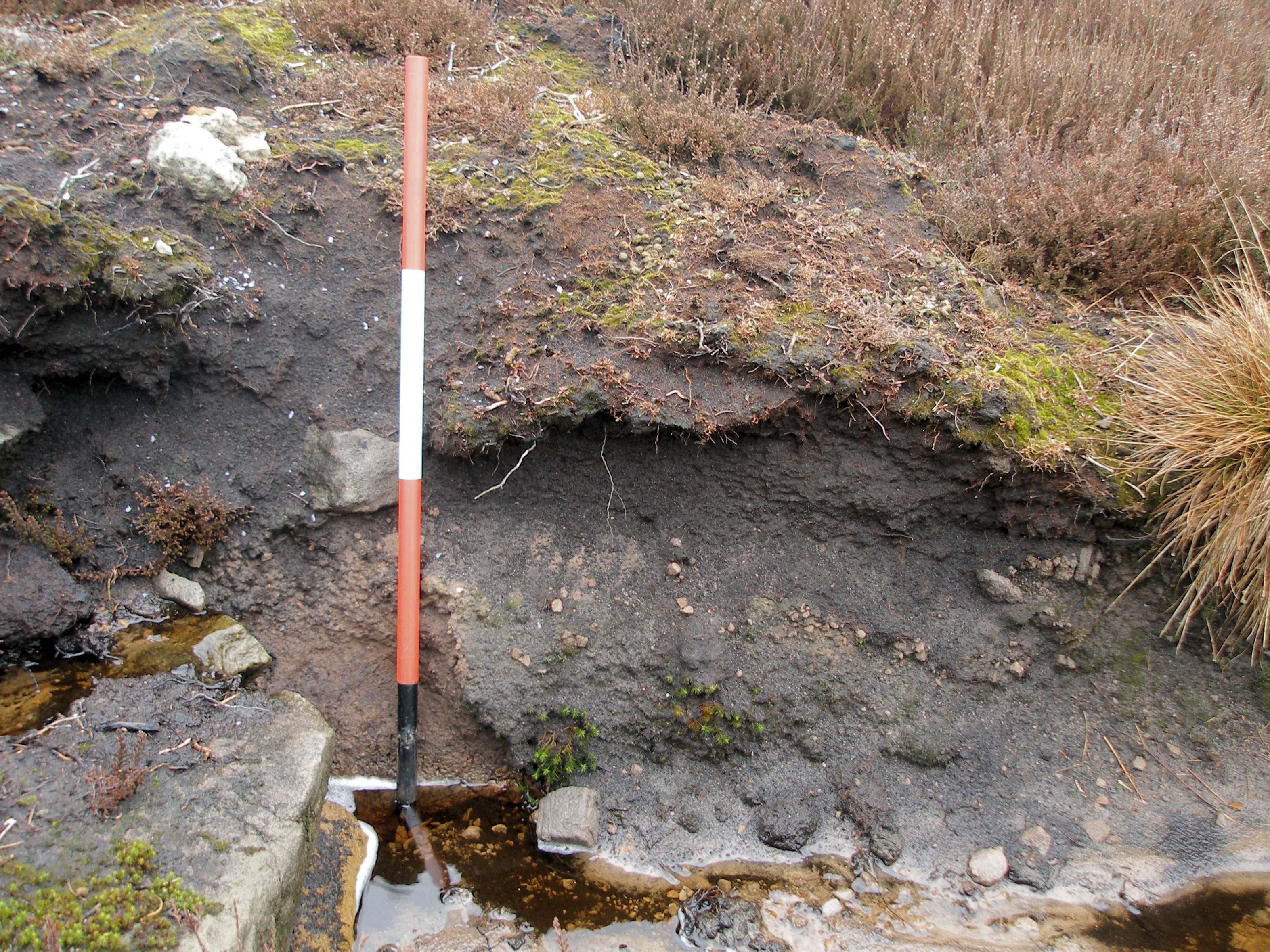
Lodge is a small ruined hamlet of four or five farmstead structures and a Methodist chapel. What’s important archaeologically is that it was abandoned in the late 1920s on completion of the neighbouring dams and reservoirs in upper Nidderdale — in order to assure clean water in the catchment area. That means nothing has been touched since abandonment, except for the gradual collapse of the latest structures, but that we also have extensive documentary records for the 19th and earliest 20th centuries. Indeed, one of our volunteer diggers had a direct family connection with the last residents! We can trace some of the inhabitants back to the 17th century when the settlement comprised traditional Yorkshire longhouses with domestic accommodation at one end and a byre or barn at the other, a yard, ancillary buildings and a garden area. There’s also a root store, recently restored, next to a stream.

Watch a short introductory video to the project by Paul Harris (1m 27) »

Clearing the building and garden area beyond

Clearing the building and garden area beyond.

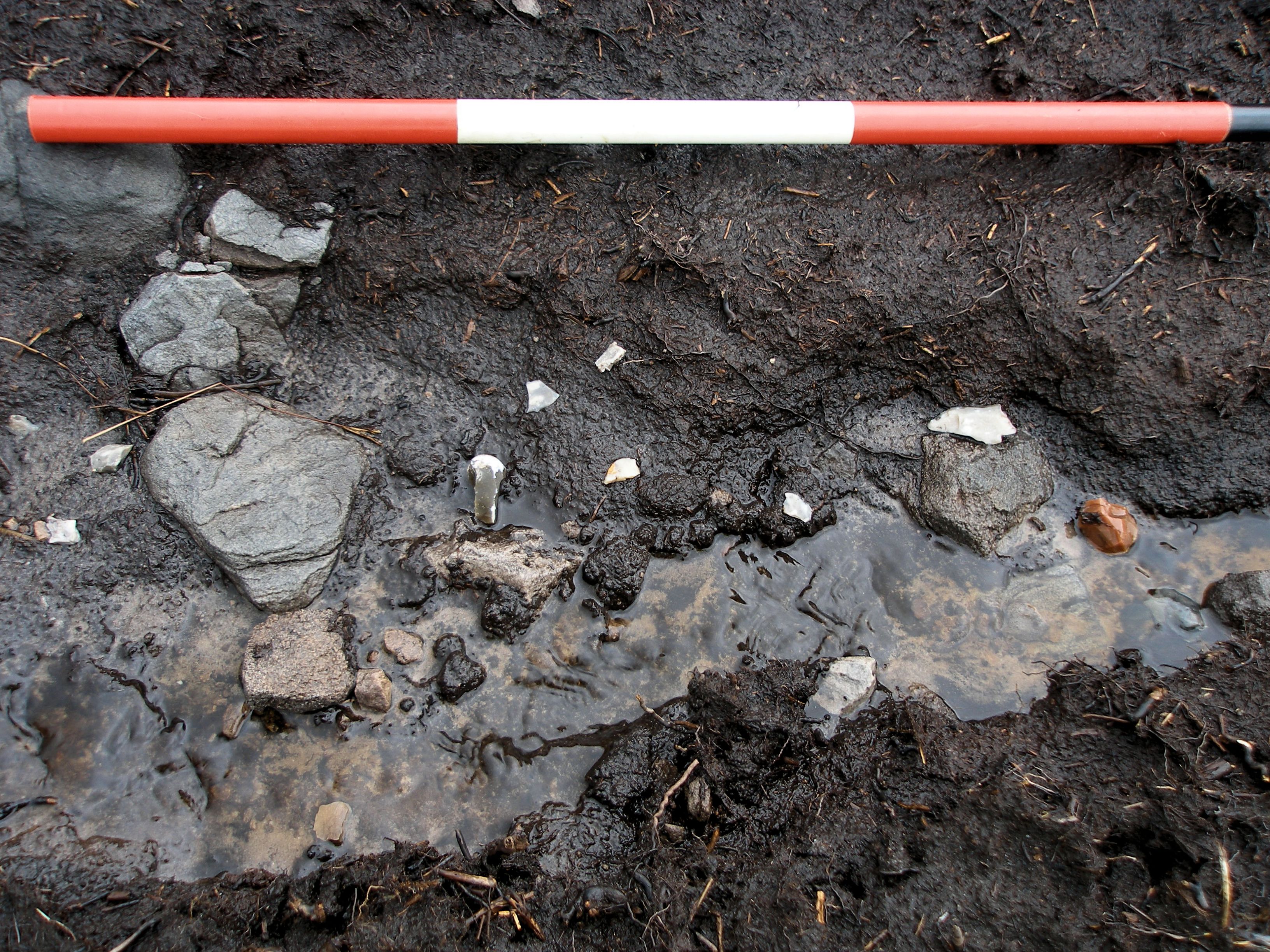
Farther back in time, the settlement is recorded on Saxton’s map of 1577 as ‘Lodge howses’, for which we found re-used architectural fragments such as stone window mullions. We also know that the Cistercian abbey at Byland, like many others, had a grange (farm) here before the dissolution of the monasteries under Henry VIII. Might we find evidence for monks? Lastly, we know that people have been here since the Mesolithic period, say around 8500–3800 BC, with extensive scatters of flint and chert artefacts recorded above Lodge and around the dale. Two flint artefacts recovered in previous surveys — and flint is not geologically native to this landscape and so must have been brought here by hunter-gatherers — probably relate to this period.


LOD16_LB-04

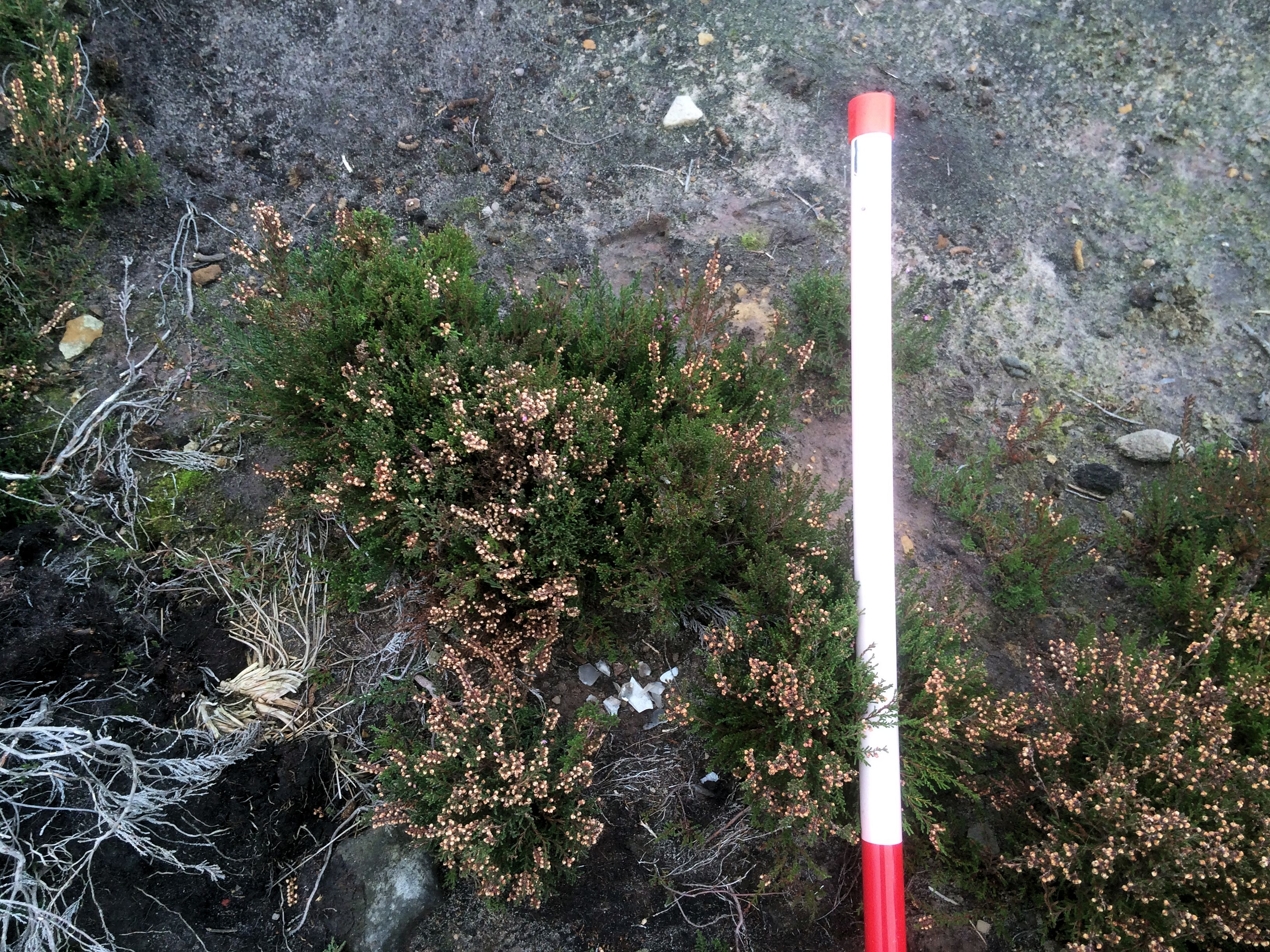
Everything from the garden trench was sieved to recover the tiniest of finds such as buttons, a faceted glass bead and shotgun cartridges.

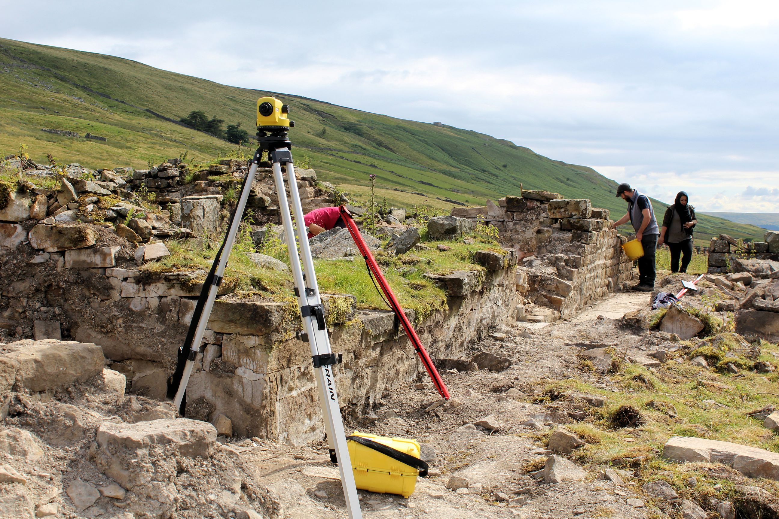
We chose one of the slightly easier structures, effectively a huge pile of rubble with a tantalising likely 17th-century window in the north wall remnant, and an area of the attached garden plot where artefacts lay immediately below the turf and through about 0.4m of wonderful garden soil. Fragments of the iron oven lay scattered amongst the rubble although a large proportion of the cooking range was subsequently recorded in situ. We did manage to uncover one of the domestic rooms — the kitchen and entrance passageway — and a cobbled-and-flagged byre with a scythe sticking out of the section.

More about Lodge and earlier surveys »

Community involvement | BIG DIG 2016!

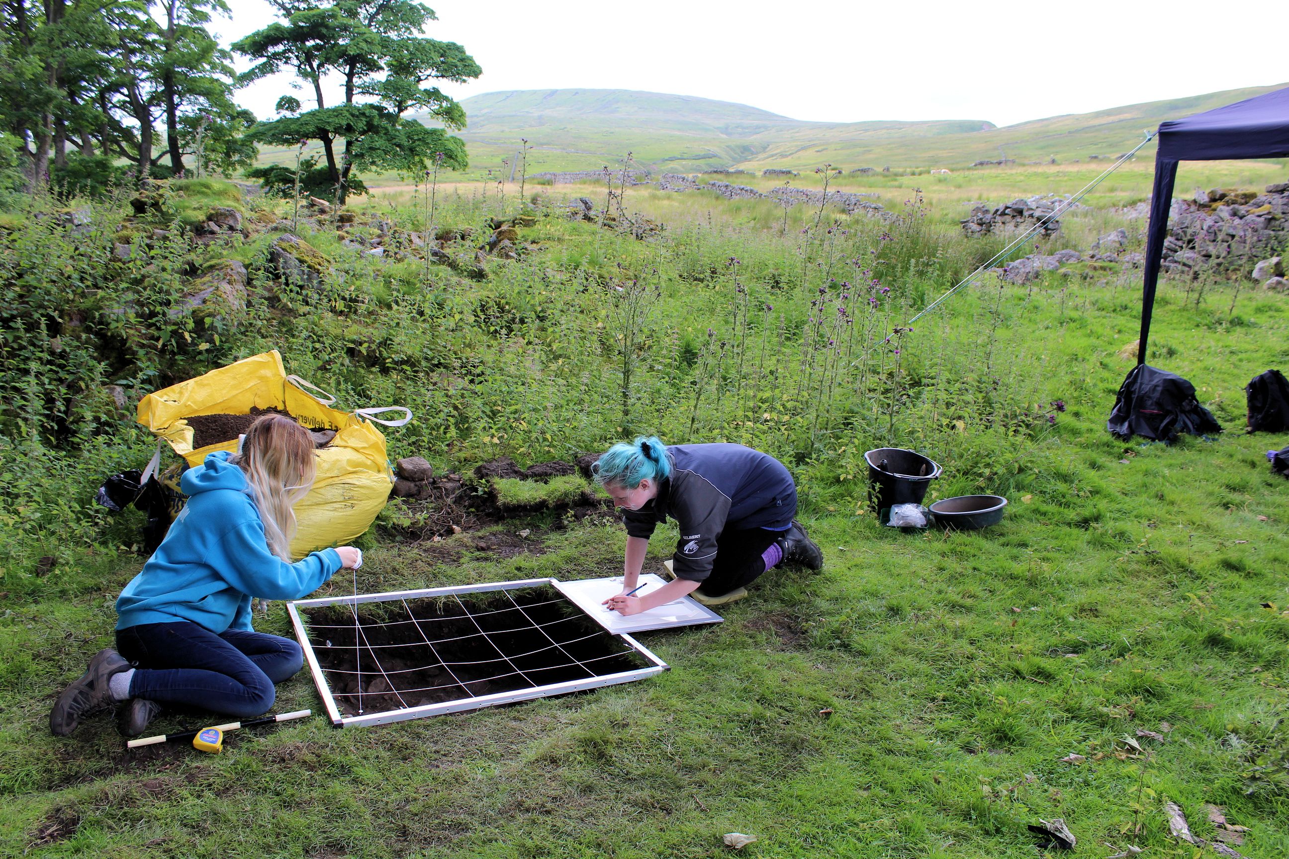
Trainee students recording a test pit.

Our excavation was Heritage Lottery funded and orchestrated by the Upper Nidderdale Landscape Partnership, with Solstice Heritage providing the archaeological oversight. We benefitted from between six and 18 volunteers on any one day — including turf removal, tens of tonnes of rubble clearance and, ultimately, backfilling the garden trench. There were experienced people who had been involved in previous fieldwork, as well as folk with no experience at all, plus two trainee undergraduate and two postgraduate students in archaeology from Bradford University, and a sixth-form student intern. All had to endure a 2.5km walk each way every day!

Mattocking in the garden trench.

Who wants to be an archaeologist?!

LOD16_LB_01In addition to an extremely successful open day in balmy summer heat with more than 40 attendees, we hosted a party of local home-educated children for some proper excavation (header image). After only a few minutes of demonstration they set to work, sharing trowelling and sieving. Their eye for detail was astounding! Almost immediately there were finds of beads, buttons, clay pipes, pottery, glass and iron. When asked “who wants to be an archaeologist?” the reply was a resounding “YES — when can we come back?”

Fragment of a clay pipe bowl with skull and cross-bones motif, popular in the late 19th and early 20th century and associated with the 17th Lancers, a cavalry regiment of the British Army notable for their participation in the Charge of the Light Brigade in the Crimean War.

Strangers in the Dale

Andy Downing and Bill Spencer in the Crown at Middlesmoor

Andy Downey of Lofthouse and Bill Spencer of Ramsgill in the Crown at Middlesmoor. Bill holds the pocket watch – “digging up time” – from the first day in the garden trench.

As word of our ventures rapidly passed down the dale it also became evident that the broader community were fascinated by what we were doing and what we might find. It was therefore a pleasure to offer a finds show and tell at the Crown Hotel, Middlesmoor with over 25 local residents and tourists quizzing us about the intriguing array of artefacts spanning at least 7000 years of activity. The pocket watch, with its loop, was the centre of attention, not least for providing a tangible connection to somebody who we can likely name.

Did we find our Monks?

Most of our finds were late Victorian and early 20th-century in date: domestic and fineware pottery along with the ubiquitous earthenware; window and vessel glass; ironwork including nails, bolts, horse/mule shoes — and one decorative example that was probably displayed above the cooking range; clay pipes and a great deal more.LOD16_LB-05

What’s interesting is that, mindful of our latterly conservative Methodist residents, there was a relative paucity of items related to bad habits, such as smoking (few clay pipes) and drinking — a very few beer-type bottle fragments and one sherd of what might be a fine sherry or wine glass. And yet, if one is permitted a moment of conjecture, we did seem to have a cluster of booze bottle fragments in the byre. Was somebody sneaking out on a bleak Sunday evening for an illicit tipple?
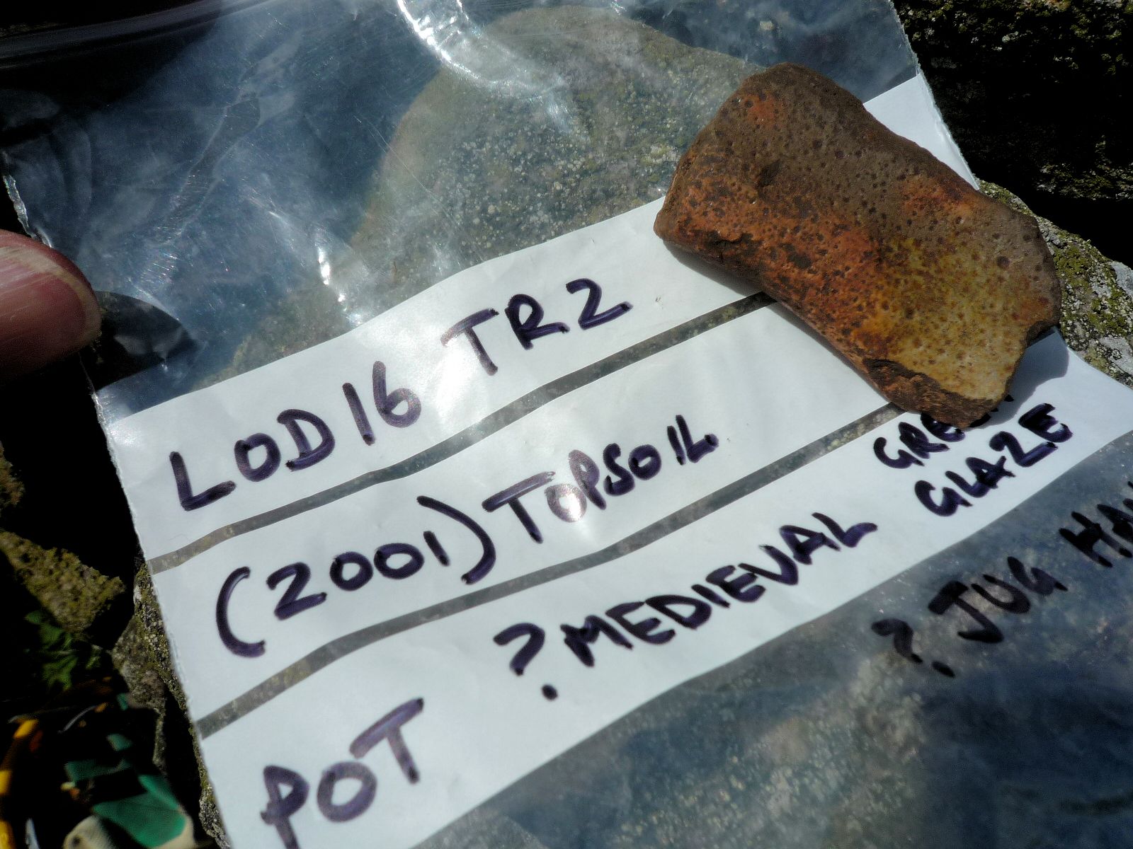
Medieval!

In fact, we have a reasonably complete sequence of pottery types heading back to the 17th and 16th centuries — and probably glassware too including hand-blown examples. Most exciting are two sherds, one a pitcher handle fragment, where the uneven firing, bubbled surface glazing and abrasion suggest an even earlier Medieval date.

Yes, we think we have our monks in a ziplock bag!

Thank you so much for reading. There’ll be plenty of volunteer opportunities ahead in Nidderdale for finds processing and, without doubt, further field projects next year.

Postscript Loo

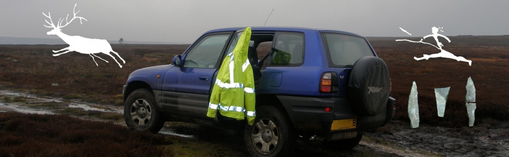
PS, it was archaeology director Jim Brightman who bravely transported the site ‘loo’ by 4×4 to Pateley Bridge for processing.


Spencer Carter | Field Archaeologist, Trainer and Lithics Specialist

Upper Nidderdale Landscape Partnership | Louise Brown
Solstice Heritage | Jim Brightman

Mesolithic Salvage | What the flint collector left behind

◊ Dear Microburins,


Update | I have added a Reporting Finds page to this blogsite. The guidance has been adopted by the Prehistoric Society on their Facebook page as a new rule of engagement.


After last week’s post about a walkover survey of a Mesolithic landscape in Yorkshire, something I do annually with permissions—and about the persisting evidence of unrecorded flint collecting¹—I’m glad to say that just enough has been left behind since 2013-14² to be able to tell some kind of story. Stones tell stories—but context is key!

The image here is rather rough-and-ready but shows, after gentle cleaning, 62 flints from the different disturbance locations, ahead of detailed analysis, cataloguing, HER submission, and archiving in a local museum. Very detailed grid references (GPS) have also been recorded. This is clearly a very small collection, but sits within a much larger archive, in the context of recent recording and volunteer regimes as part of a Historic England project, and the ongoing random activities of some participant(s) for their own various motives or habits.

Highlights

Some highlights amongst the sixty-two include:

  • Four very small cores which have been reduced with difficulty due to flaws (blue);
  • At least two microliths: a tiny and damaged microscalene triangle top R, and a possible krukowski (broken) backed bladelet, bottom L (red);
  • A burin/scraper (rare) top L, and a retouched bladelet top C (red);
  • A few other pieces show possible use-wear;
  • Burnt debitage indicating likely hearths.

However, we don’t know what the collector(s) have removed, including any possible Early Mesolithic artefacts—which are extremely uncommon in this area and are usually broad-blade microliths (projectiles)—or indeed early Neolithic artefacts such as leaf-shaped arrowheads, attractive to collectors. We’re in an area where the Mesolithic-Neolithic transition (the overlap) hints at being potentially later than other northern locations.

Glaisdale_EMThe image above was found on the Internet some years ago, posted under a pseudonym, and shows a collector’s Early Mesolithic microliths from Glaisdale. There were also images of microscalene triangles and backed bladelet forms. The area was frequently visited by collectors throughout the 20th century until recent work by Natural England to re-vegetate and re-wet an extensively eroded moorland area.

Risks

The saddest news is that many 20th century collections, and very extensive collections amounting to tens-of-thousands of finds (if not more), ultimately ended up in land fills after the collectors’ deaths. Some ended up in museums, but mixed-up and not well documented, often the result ‘of a weekend walk’ over many years. There are a number of extensive private collections today, some known, many suspected, that may end up with a similar destiny—I know of at least four, filling garage-sized spaces that would take a generation to process. Even with recent developments in best-practice recording advice (PAS, HER, MoRPHE, CIfA and otherwise) by virtue of standards frameworks, an incredible amount of data—research data—remains out of reach, off-record and hence at risk.

The Narrative So Far

  • This is a Mesolithic landscape, or ‘taskscape’, a palimpsest, a persistent place returned to repeatedly for thousands of years.
  • The lithic technology and a few diagnostic tools confirm a Late Mesolithic ‘narrow-blade’ date with activity extending a considerable distance, over 150m or more, across the moorland—dense deciduous woodland with clearances in the later Mesolithic climatic optimum—below a spring line, and farther downslope than previously recorded.TVA_LateMes
  • My own recent radiocarbon age determinations (thirteen in all, from well-defined features) suggest discreet hearth-based knapping and tool manufacture/repair can span considerable date ranges even within a few metres of each other. The calibrated dates from a rescue excavation show activity around 5300-4800 cal BC (with possible re-use of a stone-ringed hearth together with a possible structure and ‘flat stone’ features) and perhaps even 3800-3770 cal BC (at least a discreet corylus burning event), and c.4300 cal BC elsewhere—these will all be published in due course. Our understanding of the palaeo-environmental prehistory of this area is much better researched and documented than the archaeology: see References in the previous post.
  • There are also some suggestions, overall, for varying raw material procurement sources (over considerable distances), reduction stages and activities at different times and locations, although previous removals on a vast scale into the tens of thousands, when the area was much more eroded, will have compromised at least some of the surviving archaeological record.
  • When legacy references and HER records talk to ‘an assemblage composed only of debitage’, one must wonder if that is true or a function of selective flint collecting along with other taphonomic (post-depositional) processes. Our record will always be a sample of a sample of a sample.

I’ll post more, with images, when the analysis and cataloguing is complete.

Spence


¹ Evidence comprises regular sightings by the gamekeepers and farmers of at least one collector, the same gentleman each time (he used to quote my name as a legitimiser), known to leave small piles of debitage (taking the tools) and characteristic footprint patterns in all the eroding or disturbed areas where lithics are revealed. Some of his finds have been summarily recorded in the past but lack specific provenances in many cases.
² When the shooting butts and tracks were constructed.

Walkover Survey of Mesolithic Archaeology at Risk in North Yorkshire | Damned Flint Collectors

Since at least 2000, I’ve been monitoring the state of upland areas where Mesolithic lithic scatters are located (e.g. Carter 2016). We also have Mesolithic–Neolithic archaeology in the lowland zone too, generally revealed on agricultural land (fieldwalking). In addition to updating Historic Environment Records (HER) as an ongoing exercise, I note and photograph various factors such as increasing or decreasing erosion, and land management practices which can jeopardise the archaeology or, indeed, help protect it if undertaken sympathetically. Our moorland peat landscapes are also critical as carbon-capture environments.

Shooting butts and trackways | Scale: 0.2m units.

Damaging regimes include drainage ditch and track construction, shooting butt construction (with wide ‘scrapes’ and disturbance), annual heather burning in sensitive locations and, conversely, revegetation and peat re-wetting (e.g. Brightman 2014). Peat deflation—shrinkage—since the 1980s has been marked, severe in places, leaving only a shallow covering above the fragile archaeological horizons. It’s a fine balance between the needs of the landowners and farmers in a working landscape, and a desire to record and preserve our shared heritage.

Mesolithic flints in a cut drainage channel | Scale: 0.2m units.

Mesolithic flints in a cut drainage channel | Scale: 0.2m units.

Drainage channel for a shooting butt cuts through archaeological horizons: peat overlying a leached palaeosol with lithics at the interface (podsol profile). Palaeo-environmental research (e.g. Albert & Innes 2015) has provided radiocarbon date ranges for the landscape and vegetational changes happening since the last ice age (Holocene period) | Scale: 0.2m units.

Drainage channel for a shooting butt cuts through archaeological horizons: peat overlying a leached palaeosol with lithics at the interface (podsol profile). Palaeo-environmental research (e.g. Albert & Innes 2015) has provided radiocarbon age ranges for the landscape and vegetational changes, as well as likely human interference, happening since the last ice age (Holocene period) | Scale: 0.2m units.

Flint collectors and damage to the record

This flint collector (we know who he is) leaves small piles of debitage, bottom centre, after removing the ‘pretty’ artefacts (from Brightman 2014 with the author).

Sadly, evidence persists for unrecorded selective removal of flints (‘cherry-picking’ the best) which then prevents any accurate characterisation of the various sites — removing ‘pretty’ diagnostic artefacts. In reality, the entire landscape appears to have been a Mesolithic persistent place, repeatedly visited by hunter-gatherers over a period of five thousand years (c. 9000–3800 BC).

Thankfully there are just enough fragments, and debitage, to offer some insights. We know who one of the culprits is, with a large private collection, but he has since broken off contact with archaeologists. However, the estate field managers and farmers are on the look-out, and assertively discourage such behaviour.

Analysis of the lithics, GPS-plotted, is ongoing as part of my own research. Ultimately, the lithics and full records will be deposited with a local archive-accepting museum (an increasingly rare thing these days) and summarised in a regional publication or periodical. For background information, see Tees Archaeology 2006–12 (References, below).

Acknowledgements

As always, the landowners and field managers have been generous with access permission. The catch-up conversations in the wilderness are also a delight.

References

Albert, A. & Innes, J. 2015. Multi-profile fine-resolution palynological and micro-charcoal analyses at Esklets, North York Moors, UK, with special reference to the Mesolithic-Neolithic transition. Vegetational History and Archaeobotany 24(3): 357–375.

Brightman, J. 2014. Peat Restoration Historic Environment Survey and Palaeoenvironmental Assessment: Westerdale Common (Final Report). Unpublished report by Solstice Heritage for Yorkshire Peat Partnership and North York Moors National Park Authority.

Carter, S.D. 2016. Monitoring of Mesolithic Lithic Sites at Esklets, Westerdale, North York Moors, England: Field observations made in August 2015 with interim archaeological summaries | http://tinyurl.com/z6ae7w6 [Last accessed 07-Apr-2016].

Tees Archaeology 2006–12. North-East Yorkshire Mesolithic Project | http://www.teesarchaeology.com/projects/Mesolithic/Mesolithic.html [Last accessed 07-Apr-2016].

Council for British Archaeology Yorkshire | Journal in press

◊ Dear Microburins, CBAY_FORUM_vol3_cvr

I am delighted—and not a little relieved—to say that the third FORUM Yorkshire archaeological journal is now in press, the last under my editorship as I stand down from the Committee as Hon. Editor and Trustee this year.

“You’ve done a great job of rejuvenating the CBA Forum, and we will certainly want to provide further contributions to the journal in the future.” – Mitch Pollington, AOC Archaeology Group

Publishing this volume, pertaining to the year 2014, in May of 2015 reflects the timing and nature of fieldwork in both the commercial and community sectors, where either post-excavation analyses are still underway or where the writing up of reports, even interim summaries, usually takes place over the winter season. I suspect that this will be the ongoing rhythm for future editions, even if it means missing the opportunity to distribute copies at the CBA Yorkshire Annual General Meeting and Symposium event early in each calendar year. Such are these pressures on time, it is also difficult to build up a pipeline of future papers without those also becoming dated.

“If the next editor is half as good as you, the journal will be in safe hands.” – Ed Dennison Archaeological Services

I am particularly pleased that we are able to present papers aligned to the Communities in Action theme which we introduced last year. The cover image attests to the fantastic planning, fieldwork—and fascinated results—achieved so far in the Swaledale Big Dig, by example. While we do not have any Behind the Scenes papers this year (unfortunately the one on OASIS did not materialise), there is still an opportunity for specialists—whether in archaeological, heritage or museum practices, and their allied sciences—to offer insights into the areas of the discipline that might not otherwise be well understood.

Appreciation

CBAY_Symposium01Once again, I remain indebted to the authors for their time, enthusiasm and tolerance—both those whose papers appear in this volume and those who have promised papers for the next edition. Above all, I am grateful to the CBA Yorkshire Committee and Trustees for their wonderful support over these last three years. It has been a privilege for me, thank you. I will be working with the new editor on a smooth transition and to make last year’s FORUM Yorkshire Volume 2 available as free-to-download, fully open-access, on our website (PDF format and e-magazine style).

Interested in Yorkshire Archaeology?

Why not think about joining CBA Yorkshire, run entirely by volunteers, for the benefit of those interested in the welfare and better understanding of Yorkshire’s historic environment? It aims to encourage and promote greater public knowledge and involvement, and where possible to advance and assist relevant research—ARCHAEOLOGY FOR ALL.

There are also a number of positions available on the Committee, which meets in York four times each year. We are particularly looking for a Web & Social Media officer and Education officer, amongst other roles.

Spence

Symposium image courtesy of Eric Houlder.