 Since at least 2000, I’ve been monitoring the state of upland areas where Mesolithic lithic scatters are located (e.g. Carter 2016). We also have Mesolithic–Neolithic archaeology in the lowland zone too, generally revealed on agricultural land (fieldwalking). In addition to updating Historic Environment Records (HER) as an ongoing exercise, I note and photograph various factors such as increasing or decreasing erosion, and land management practices which can jeopardise the archaeology or, indeed, help protect it if undertaken sympathetically. Our moorland peat landscapes are also critical as carbon-capture environments.
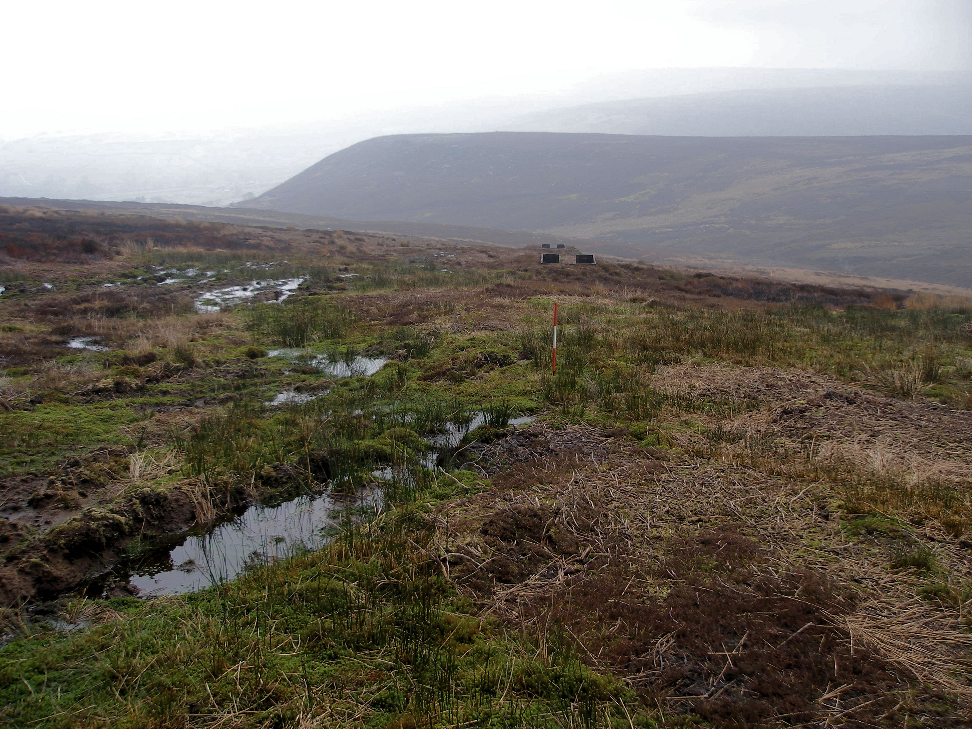
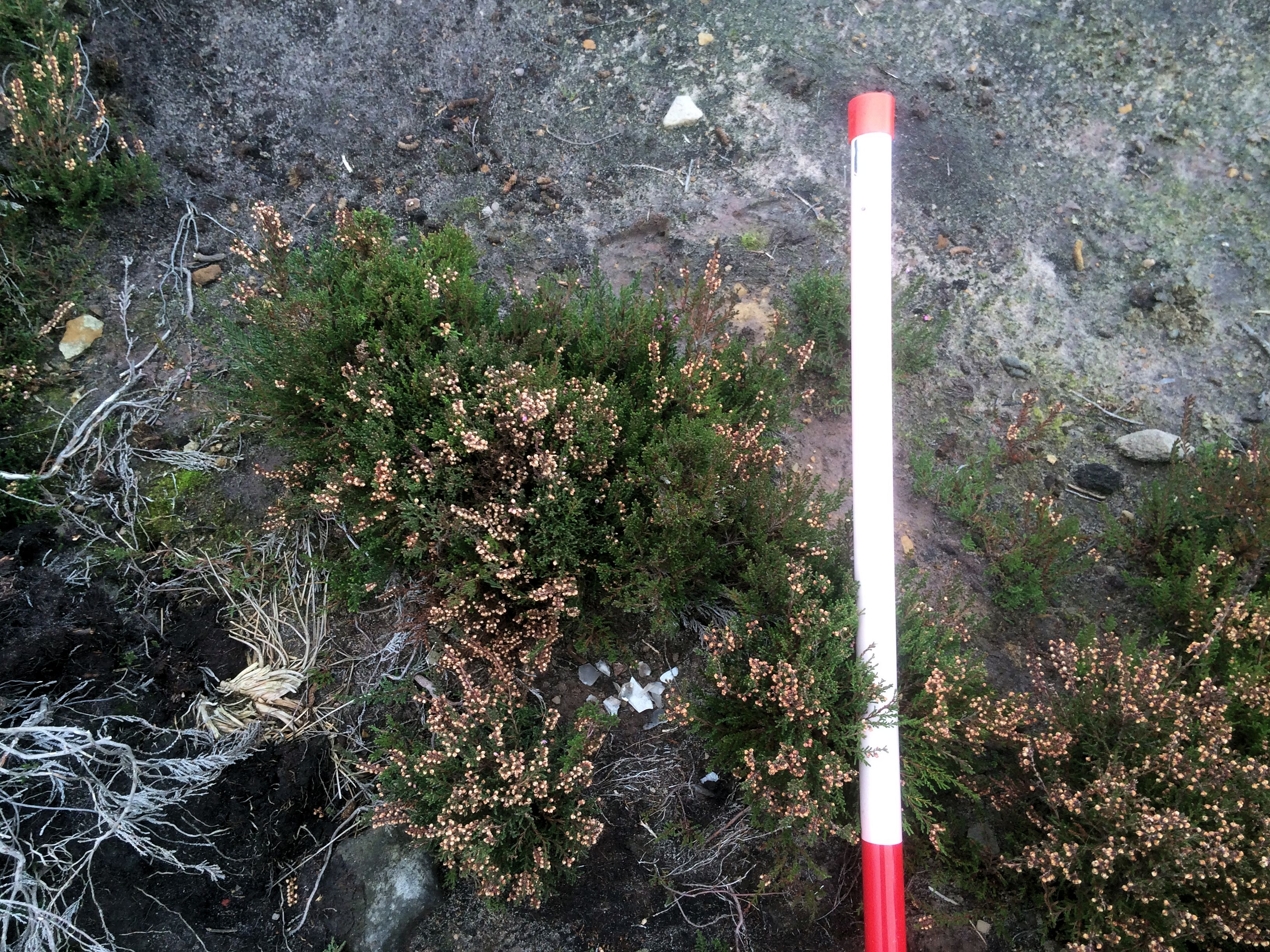
Shooting butts and trackways | Scale: 0.2m units.
Damaging regimes include drainage ditch and track construction, shooting butt construction (with wide ‘scrapes’ and disturbance), annual heather burning in sensitive locations and, conversely, revegetation and peat re-wetting (e.g. Brightman 2014). Peat deflation—shrinkage—since the 1980s has been marked, severe in places, leaving only a shallow covering above the fragile archaeological horizons. It’s a fine balance between the needs of the landowners and farmers in a working landscape, and a desire to record and preserve our shared heritage.
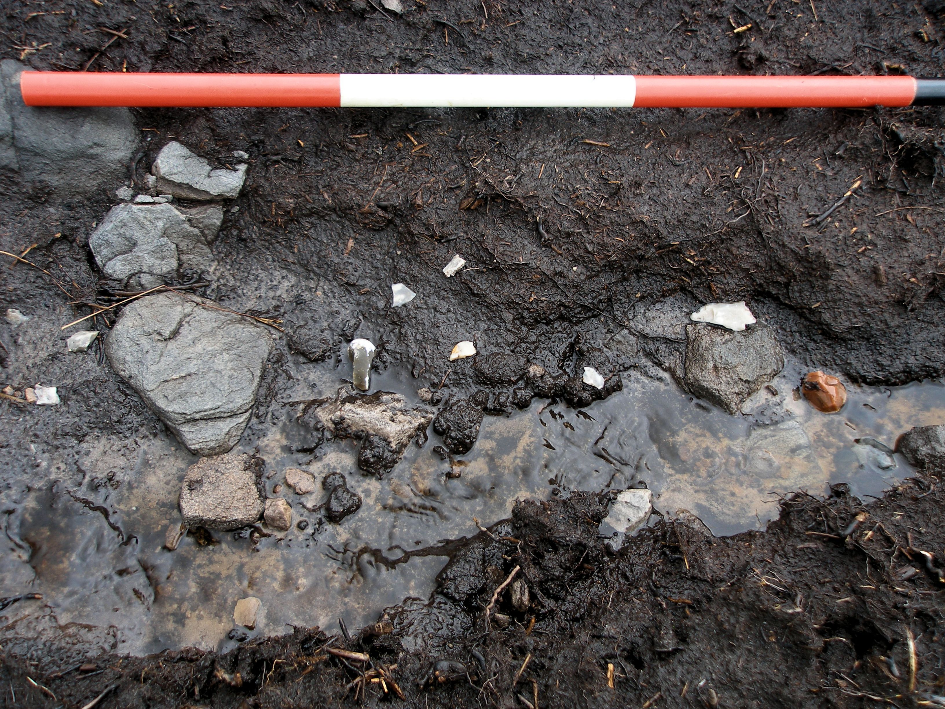
Mesolithic flints in a cut drainage channel | Scale: 0.2m units.
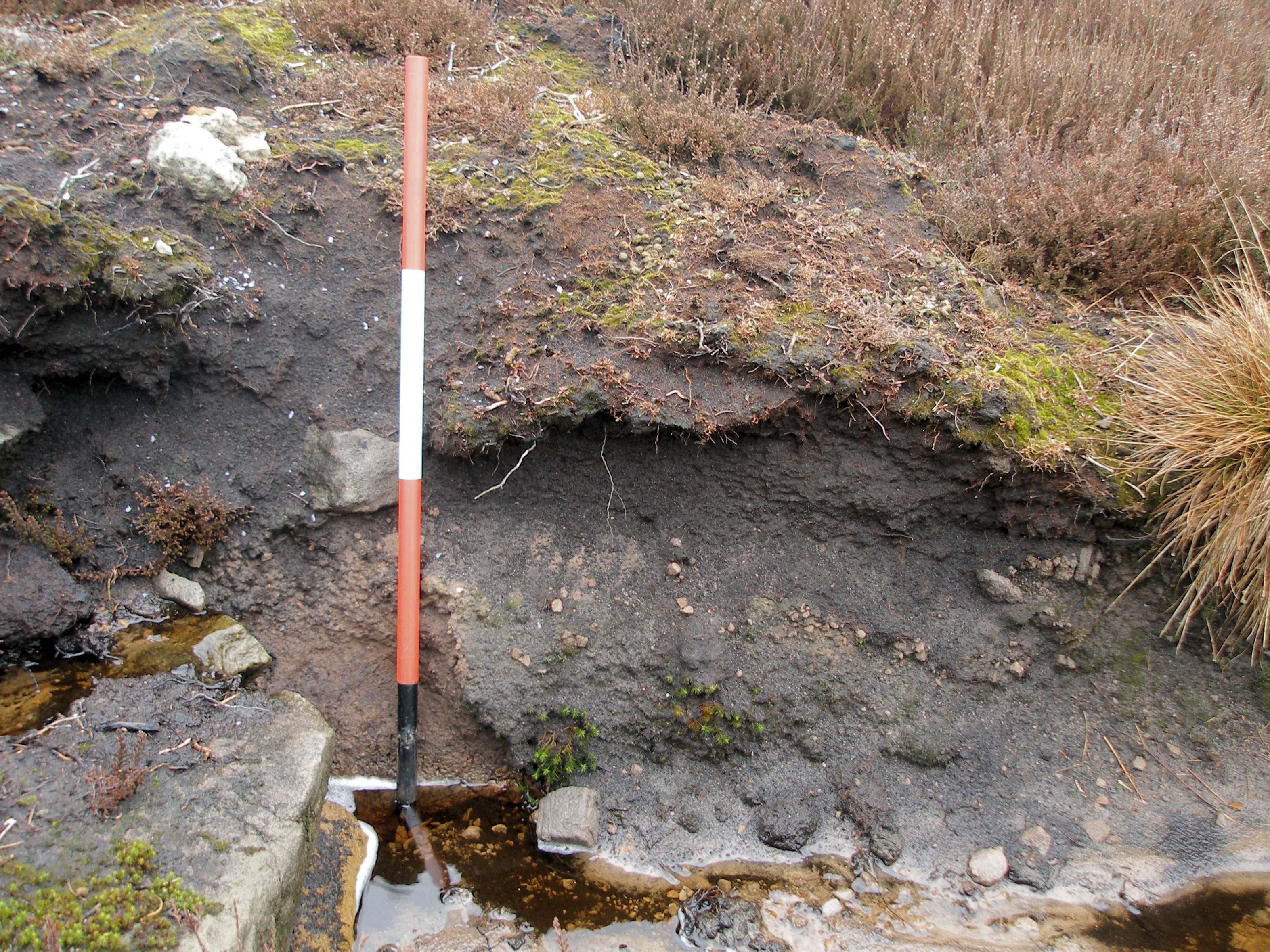
Drainage channel for a shooting butt cuts through archaeological horizons: peat overlying a leached palaeosol with lithics at the interface (podsol profile). Palaeo-environmental research (e.g. Albert & Innes 2015) has provided radiocarbon age ranges for the landscape and vegetational changes, as well as likely human interference, happening since the last ice age (Holocene period) | Scale: 0.2m units.
Flint collectors and damage to the record
This flint collector (we know who he is) leaves small piles of debitage, bottom centre, after removing the ‘pretty’ artefacts (from Brightman 2014 with the author).
Sadly, evidence persists for unrecorded selective removal of flints (‘cherry-picking’ the best) which then prevents any accurate characterisation of the various sites — removing ‘pretty’ diagnostic artefacts. In reality, the entire landscape appears to have been a Mesolithic persistent place, repeatedly visited by hunter-gatherers over a period of five thousand years (c. 9000–3800 BC).
Thankfully there are just enough fragments, and debitage, to offer some insights. We know who one of the culprits is, with a large private collection, but he has since broken off contact with archaeologists. However, the estate field managers and farmers are on the look-out, and assertively discourage such behaviour.
Analysis of the lithics, GPS-plotted, is ongoing as part of my own research. Ultimately, the lithics and full records will be deposited with a local archive-accepting museum (an increasingly rare thing these days) and summarised in a regional publication or periodical. For background information, see Tees Archaeology 2006–12 (References, below).
Acknowledgements
As always, the landowners and field managers have been generous with access permission. The catch-up conversations in the wilderness are also a delight.
References
Albert, A. & Innes, J. 2015. Multi-profile fine-resolution palynological and micro-charcoal analyses at Esklets, North York Moors, UK, with special reference to the Mesolithic-Neolithic transition. Vegetational History and Archaeobotany 24(3): 357–375.
Brightman, J. 2014. Peat Restoration Historic Environment Survey and Palaeoenvironmental Assessment: Westerdale Common (Final Report). Unpublished report by Solstice Heritage for Yorkshire Peat Partnership and North York Moors National Park Authority.
Carter, S.D. 2016. Monitoring of Mesolithic Lithic Sites at Esklets, Westerdale, North York Moors, England: Field observations made in August 2015 with interim archaeological summaries | http://tinyurl.com/z6ae7w6 [Last accessed 07-Apr-2016].
Tees Archaeology 2006–12. North-East Yorkshire Mesolithic Project | http://www.teesarchaeology.com/projects/Mesolithic/Mesolithic.html [Last accessed 07-Apr-2016].
